Maps as Palimpsests & Grimoires
& a nexus of place writing

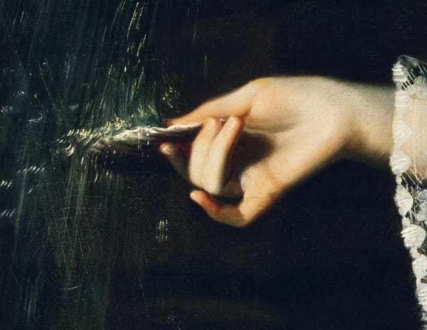
I have this thing about maps. I have always written using maps—even ones of my own invention, of alternate realities. Maps are magic, allowing temporal shifts and sidereal travel. While writing Ashes and Stones I created a custom Google map of all the locations I researched, adding notes & cross referencing with pastmap.com which compiles heritage sites, the archeological record and more, superimposed on an aerial photo of an Ordinance Survey Map base layer. (You can even time travel to see older maps going back to the 19th century.) A year after I began this mapping, the University of Edinburgh published the Witches Map, a data set of the comprehensive Survey of Witchcraft, and that changed everything! I have started to compile a similar writing-map for witch-lore in Orkney and Shetland which will inform future work.
This spring I’ll be offering Writing Yourself Home, my place-writing masterclass, which also uses maps as a writing tool. Watch this space!
On this full moon, I’m sharing a post I wrote in 2009—displaying the absolute continuity of my mapped-out-geekdom. Back before I had a cell phone with a map app, I used paper maps. This is about my love of the London A to Z.
Over 30,000 Streets in Your Pocket
Before I leave the flat, I often consult the codex of the A-to-Zed, the exhaustive walking map of London. (It’s not an A to Zeee. No, never!) I have no shame in taking it out on the street, appearing lost, or worse–a tourist. It is because I love it so. Often, even when not leaving the flat, I read the city in this way. The place names suggest stories I have read or have not yet been written, the density of history.
Missives from the Verge with Allyson Shaw is a reader-supported publication. To receive new posts and support my work, consider becoming a free or paid subscriber.
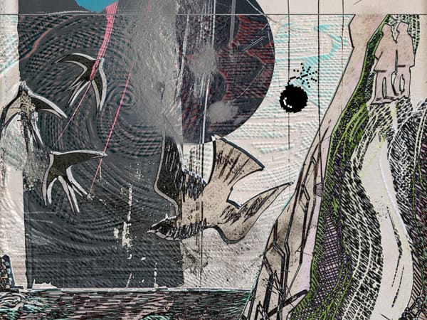
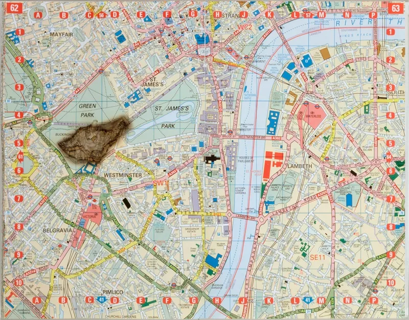
Artist Cornelia Parker’s A to Z has a hole burned through it [shown above]. If one were to turn the page, surely the meteorite would have also obliterated Westminster Bridge on the next page, and might just miss Waterloo Station as it would surely take all of Borough Market, Druid Street and Tabard, where I am supposed to go this evening.*

I have made a note of my destination, not far from the Marshalsea Road and a place I have never been which is now called Little Dorrit Park, named after my favourite Dickens novel. Much of my London geography I owe to Dickens. Long before I picked up an A to Z, his London was mine. When I’m blue I often say to myself, Let’s see what’s going down at the Marshalsea Prison and I will pick up the novel and begin reading at random.
I haven’t made many literary pilgrimages in the four years since I moved to London, probably because they are always a disappointment, either completely missing from the landscape of chain stores, luxury flats and tourist crowds—or they are overly mediated Heritage sites. There is something joyless about having someone else’s official dream imposed upon your own.
In the A to Z London returns as a tabula rasa, a web of place names held in the hand. Even the name suggests the sprawling labyrinth of London could somehow be alphabetised to order. Everyone orders London differently, the maps of our minds no doubt carry with them distortions, contractions and omissions. Cornelia Parker’s Tube Map brochure from last year suggests this by using the iconic colours as an ink blot.
Books are also maps of a kind. Tonight I might just visit Little Dorrit and make something of it, leave there a little of my own jealous imagination.
*Where was I going? Was it to Beer Mile? I was writing a lot about craft beer in those days and even belonged to the British Guild of Beer Writers. I wish I hadn’t been so coy about it!
Missives from the Verge with Allyson Shaw is a reader-supported publication. To receive new posts and support my work, consider becoming a free or paid subscriber.